Our Proposal
“There’s an old saying of miners, ‘If it can’t be grown, it has to be mined.’ Mining provides, directly or indirectly, many of the raw materials needed to sustain life and maintain civilization.
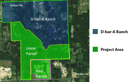
Where – The Project Site includes 724 acres in Metamora Township, Lapeer County, MI; 154 acres of this site are owned by American Aggregates of Michigan (AAOM) and the remaining 570 acres are owned by the Boy Scouts of America (BSA), and are under a lease agreement with AAOM.
How – Typical aggregate mining equipment will be utilized during the mining activity, including bucket loaders, transport trucks and conveyors. An aggregate processing plant will be constructed on the east side of the site. Mining activity is not expected to go below the water table on the site. The preparation of the land for mining will be done on an as-needed basis, leaving existing land cover in place until removal is required for mining activities. Similarly, reclamation will be completed on an on-going basis such that the area disturbed by mining at any one time will be limited to what is required for efficient, safe, and responsible operations. Mining and reclamation plans include mitigation measures to limit the impact of the mining activity on the community and natural environment.
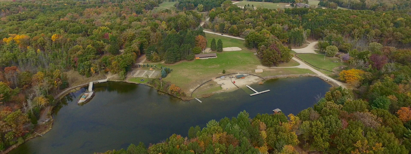
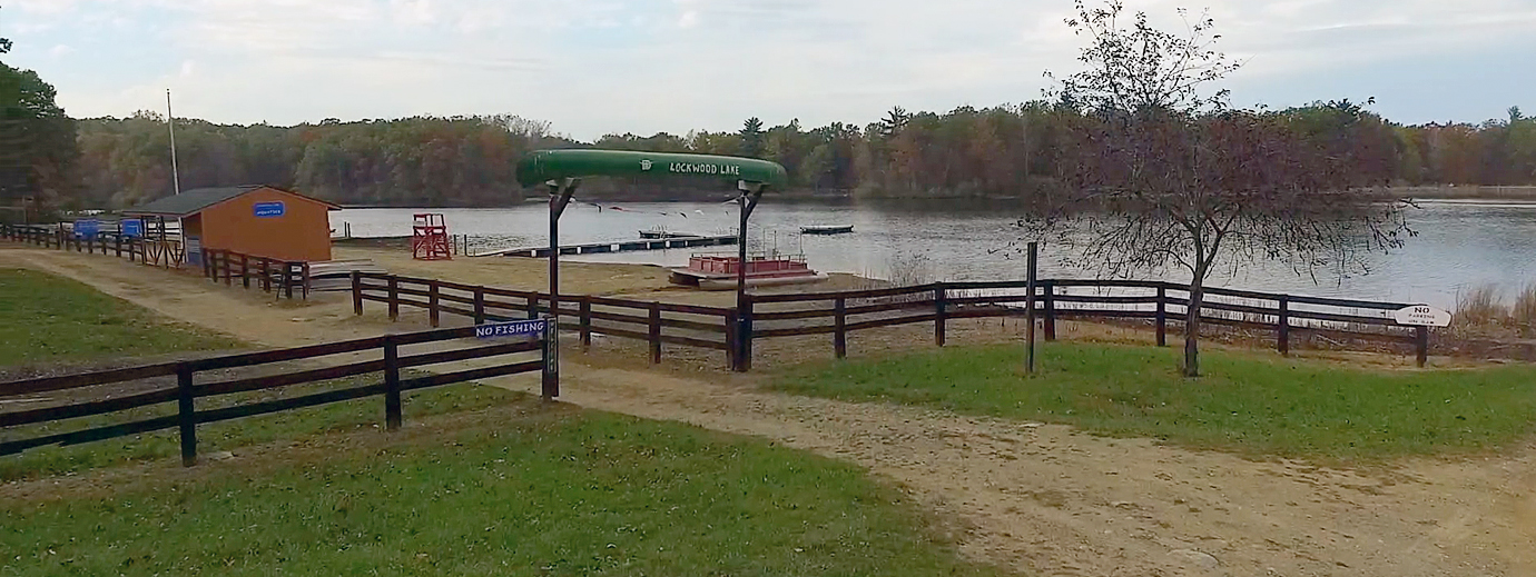
At the completion of mining operations, site reclamation will result in range of land form types and habitats, and a land shape conducive to recreational and agricultural uses desired by the BSA.
When – The estimated extraction activity will take place in five distinct phases, which will be completed in approximately 30 years, subject to market conditions.
Mining and Reclamation
Of the 724 acre Project Site, 496 acres are included within the Mining Area. The remaining 228 acres of land are located in preservation areas or setbacks, and will not be disturbed by sand and gravel extraction activity. Construction of earth berms will occur in the mining setback area to mitigate visual and noise impacts during each mining phase. During final reclamation work, land within the setbacks and buffer areas may experience minor landscape clearing and earth shaping to ensure a safe and smooth transition of grades; however, no such activity will impact regulated wetlands.
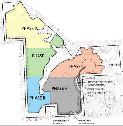
PHASE I
- Phase I mining operation will encompass 102 acres and will be located on the eastern side of the Project Site. Initial mining efforts will focus on creating a level base for the installation of the long-term processing plant, as well as excavating areas for settling ponds and fine sand storage. A pond will be excavated near the processing plant for use in storing wash water. The pond will receive water from both the closed looped recycled water process and from the water well located near the plant.
PHASE II
- Work will continue into Phase II (83 acres in size) above the water table in a similar fashion as in Phase I, described above. Berms will be constructed along the western boundary of the Project Site as noted above. A conveyor will be extended into the Phase II area, and the mining activity will generally move from east to west
PHASE III
- Once mining efforts are complete in Phases I and II, the work will shift to Phase III (63 acres) at the southwestern side of the Project Site. The field conveyor and feed hopper will be extended to the south from the Phase II area. Part of the Phase III area will be integrated into the aggregate wash water recirculating system and silt and fine sand storage. Topsoil and overburden exist in sufficient quantities in Phases II and III to reclaim the pit floor of these phases.
PHASE IV
- Phase IV (132 acres) will shift extraction work to the northwestern part of the Project Site and will progress from the south to the north and west. The field conveyor and feed hopper will be extended to the north from the Phase II area. Overburden and topsoil quantities exist within Phase IV in sufficient amounts to reclaim both the pit floor and the high bank on the western and northern edges of the property during and immediately following the mining of this phase.
PHASE V
- The final phase of work, Phase V, is 116 acres in size and includes the area south and west of the processing plant site. The overburden and topsoil in Phase V are in greater quantities than are required for the basic reclamation of this phase; some of the initial overburden taken from Phase V will be hauled to Phase II and III to reclaim the mining face on the western edge of the mining area. At the close of mining operations, all reclamation efforts will be finalized and the processing plant, administrative office and related facilities removed from the Project Site.
Reclamation Plan
The proposed Mining and Reclamation Plan conforms to Township ordinances for slopes, topsoil, erosion control and wetland protection. The Reclamation Plan illustrates the general land slope and configuration of the site, post-mining. The reclamation activities are specifically planned to shape the property for productive re-use, as discussed elsewhere in the Community Impact Statement.
For more information see the Community Impact Statement.
The Boy Scouts of America have established a list of potential uses of the Project Site that will benefit both the operations of the D-bar-A Ranch as well as the diversity of recreational opportunities available for Boy Scouts. The key to integrating new uses into the D-bar-A Ranch is the use of mining and reclamation to shape the land in ways that can accommodate the new uses.
The reclamation of the site creates opportunities for the BSA to participate in re-forestation activities, planting native trees, shrubs and grasses to stabilize the soils, agricultural production, and creating habitat on a regular ongoing basis, as mining and reclamation proceed.
Sustainability through Resource Management
“Mining directly affects the natural resources environment while working to meet the needs of a modern global economy. In this way, the job of mining is unique. The industry must find and extract mineral resources, while keeping in mind that sustainability calls for meeting the needs of future generations and conserving the environment. That means balancing the demand for products and materials with good stewardship of the land.”
Community Impact Studies
- This report has been prepared to evaluate and document the potential environmental and community impacts of a proposed sand and gravel mining operation in Metamora Township, Lapeer County, Michigan, in accordance with Section 1533 Community Impact Statement Requirements of Ordinance 23 Metamora Township Zoning Ordinance.
- Community Impact Statement


- This report presents the results of an aggregate market study for Southeast Michigan including the counties of Wayne, Oakland, Livingston, Washtenaw, Monroe, Genesee, St Clair, Lapeer and Macomb. The purpose of this study was to evaluate the supply and demand for construction aggregate in the 9 county market area and evaluate related public impacts. Emphasis was placed on the inter-relationships between various types and origins of aggregates, transportation of aggregates to the market and most common usage of each type of aggregate.
- Aggregate Market Assessment
- Examine the existing biological resources at the D-bar-A Project Site along with anticipated effects of the proposed mining activity. The biological resources include wetlands, surface water bodies, woodlands, vegetative cover and wildlife.
- Environmental Assessment of Biological Resources
- Utilizing existing data from soils explorations conducted by Levy and well logs available at the County for adjacent drinking water wells, assess the impacts of the mining activities and ground water use during processing on adjacent drinking water wells and wetlands, water bodies and streams.
- Hydrogeological and Environmental Assessment Report
- SRR was engaged to determine if any impact in value occurs to residential properties along truck haul routes and within close proximity to mining facilities. Further, if any impact has occurred, to provide to the best of our capabilities an opinion as to the amount of the impact.
- Property Value Impact Analysis
- Utilizing existing permitted operations as a benchmark, assess potential for noise impacts and the typical mitigation measures undertaken.
- Noise Study
- Conduct field measure of traffic volumes on up to six sites along Dryden Road. In collaboration with AAC, establish trip generation and distribution pattern, and provide computer model of existing conditions, background growth, and forecast conditions for each of the study sites.
- Traffic Study
- The following authorities, permits, and related rules and regulations may be applicable for typical sand and gravel mining sites. AAOM will apply for and adhere to such permits and authorities as appropriate for the proposed mining activity.
- MDEQ Permit Regulations
- US Department of Agriculture, Natural Resources Conservation Service to generate a Custom Soil Resource Report for Lapeer County, Michigan within the approximate mining boundary.
- USDA NRCS Soil Resources Report
- Vibrations caused by the extraction and processing of the sand and gravel are limited to those associated with standard earth moving and processing equipment. Vibration from this type of sources typically dissipates through the soils immediately surrounding the source, and do not impact adjacent properties. No explosives will be used or blasting undertaken at the proposed mine site.
- Community Impact Statement
- Utilizing existing permitted operations as a benchmark, assess potential for air quality impacts and the typical mitigation measures.
- Community Impact Statement
- With available topographic and geologic mapping, describe the character of the land and the geologic formations present in the region and site. Analyze soil boring data collected from the site to assess the relative quality and quantity of the natural resource, and demonstrate its suitability for sale in the market.
- Community Impact Statement
- Compare the existing topographic maps and USGS mapping of the region with the proposed mining plan to model and assess changes to surface water hydrology, particularly as it may impact regulated wetlands, streams, and water bodies, both within the mining area and adjacent to it.
- Community Impact Statement
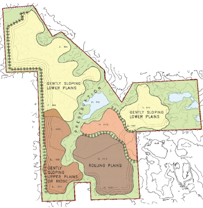
- Identify the quantity and quality of the soil composition on the project site based off of the soil series as identified in the U.S.D.A Web Soil Survey.
- Community Impact Statement
- Examine existing planning and zoning documents and address limited impacts on adjacent land uses (see SLU checklist and PA 113); how the conditional rezoning and subsequent mining will have a positive impact on Boy Scouts; why is this the best zoning for land and is not a spot rezone; how does this land use represent a “reasonable and rational relationship to the property” (see rezone checklist).
- Community Impact Statement
- Examine potential impacts on local community utilities and services related to public safety, fire safety, education, and recreation.
- Community Impact Statement
- Research and identify the socioeconomic environment around the project site and potential impacts of the project.
- Community Impact Statement
- Examine the potential and expected impacts of the operation on the proposed site and surrounding properties as it pertains to visual quality.
- Community Impact Statement